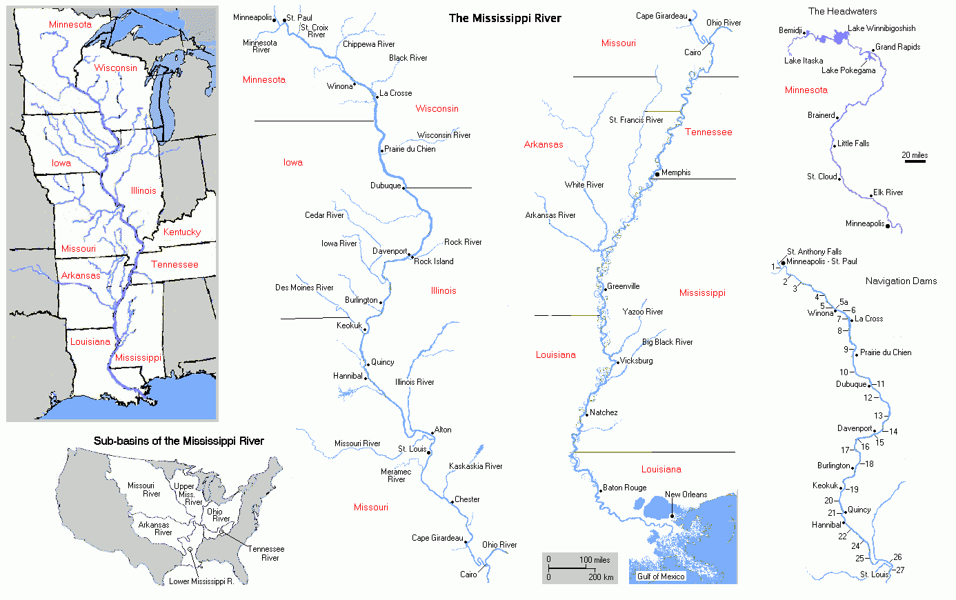

Look at a map of the Mississippi River and follow its long curve through the heart of the continent. Along the way, tributaries join it, towns cluster near its banks, and roads and rail lines cross its path. Before the interstate system, before modern trucking, a river landing could be a community’s connection to the wider world.
Imagine a wagon arriving at the water with sacks of grain, a merchant checking a shipment, and a family waiting for a boat that will carry them to another town. The landing is noisy and busy, but it is also a place of uncertainty. Will the boat arrive on time? Has the river risen? Will the goods reach their destination before the season changes? For people whose livelihoods depended on transportation, the river was both a road and a force that could not be controlled.
Why Towns Grew Beside the River
Some settlements developed where tributaries met the main channel. Others grew near ferries, natural landings, mills, bridges, or places where cargo could be transferred to wagons. These locations brought together farmers, boat crews, merchants, warehouse workers, and travelers. A modest landing could support stores, hotels, repair shops, and markets because people needed food, lodging, equipment, and services while goods moved through.
These routes were not created from nothing when American settlers arrived. Indigenous peoples had long traveled and traded along the river system. Later settlement brought new boundaries and commercial networks, as well as displacement and conflict. Historic maps can help us follow transportation routes, but they should be read alongside Native histories and local records to understand who used the land and how control of it changed.
The Work of a River Town
River commerce depended on people whose names rarely appeared in national histories. Pilots learned the channel; deckhands handled lines; mechanics repaired engines; warehouse workers moved cargo; teamsters carried goods inland; and shopkeepers supplied the crews and travelers. Farmers watched the river because it could carry a harvest to market, while merchants depended on boats to bring goods they could not make locally.
Old photographs and newspapers make these communities more visible. A photograph may show a landing, a warehouse, a steamboat at the wharf, or a street leading toward the water. A newspaper might report a new ferry schedule, a flood, a boat arriving with freight, or a business opening near the landing. Such details turn a map into a human story.
For a period visual source, the Library of Congress preserves a photograph titled “A Mississippi River boat,” made in 1906. Its catalog record identifies the Mississippi River as the location and the Detroit Publishing Company as the contributor. It offers a concrete starting point for thinking about the boats and people that linked river communities in the early twentieth century.
Floods, Railroads, and Change
The river could provide opportunity and threaten it in the same season. Floods damaged homes, farms, roads, and businesses. Shifting channels could change where boats could safely land. As railroads expanded, some towns found new connections while others lost traffic to a nearby depot or larger center. A community’s future could depend on geography, investment, weather, and decisions made far beyond its boundaries.
River commerce also carried the unequal history of the region. In parts of the Mississippi Valley, transportation supported the slave economy, while Indigenous communities experienced land loss and forced change. The prosperity of some businesses existed alongside the exploitation of others. Remembering river towns honestly means recognizing both their resourcefulness and the costs of the systems in which they operated.
Finding the Old Landing Today
Some historic landings have disappeared beneath levees, roads, industry, or new development. Others survive as parks, boat ramps, old warehouses, street names, or bends in a road that seems to lead toward nowhere. Local museums, county histories, historic maps, and digitized newspapers can reveal what once stood there.
Perhaps you have crossed a bridge or driven along a riverfront without realizing that a busy landing once stood nearby. Learning the history changes the view. The water becomes more than scenery: it becomes a witness to journeys, labor, disasters, arrivals, departures, and generations of people trying to make a life.
At Echoes of America Journal, we will keep following these connections. Every river town has its own story, but together they remind us how closely the communities of the heartland have always been linked.
Watch and Explore
Explore the National Park Service resource on steamboats on the Missouri River, and view the Library of Congress photograph “A Mississippi River boat” for an archival glimpse of river transportation.
A River Crossing in Abraham Lincoln’s Young Life
Before Abraham Lincoln became president, he traveled the Mississippi as a young man on flatboat journeys to New Orleans. Those trips exposed him to the commerce of the river and to the stark realities of slavery, including the sale of enslaved people in the city. The river carried goods and travelers, but it also connected places shaped by a deeply unequal system of labor and law.
Lincoln’s early river journeys remind us that transportation routes do more than move cargo. They bring people into contact with places and realities beyond their home communities. A landing might be a point of departure for one family, a place of work for another, and a scene of injustice for someone denied freedom. River-town history becomes more honest when we see those experiences side by side.
For historical context, consult the Lincoln Home National Historic Site and the Abraham Lincoln Birthplace National Historical Park. We should distinguish documented accounts of Lincoln’s journeys from later stories that may have embellished them.
Coming Up Next
On Friday, we turn from river routes to the canvas, exploring how American artists recorded landscapes and helped shape the way the nation imagined its own land.
Join us Friday for “A Landscape in Paint: How American Artists Preserved a Changing Nation.”
Leave a Reply